5 Reasons to Use Drones in Agriculture

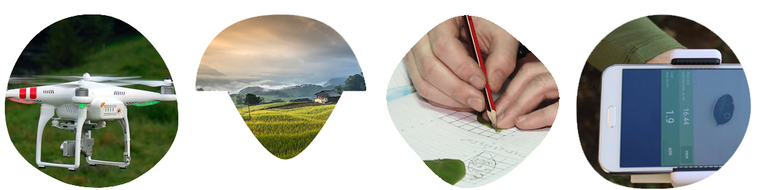
The use of drones in agriculture is well-established and there are numerous case studies demonstrating their effectiveness in increasing yields through the data they collect. But what are the primary areas in which drones are used in agriculture and how can they benefit ordinary farmers and landowners?
Agricultural experts have identified several key advantages of drones in agriculture, which we will delve into in more detail.

1. Aerial photography of the fields and crops
Aerial photography involves taking pictures of an area from the air, typically using aircraft or satellites, to create topographic maps, plans, and digital terrain models. This process involves overlapping images and comparing their overlap, in contrast to linear aerial photography which only requires overlapping images in a single direction. Drones and aircraft can be used to quickly gather a large amount of data on a field. Once the images are taken, they must be analyzed to obtain useful information. There are various methods for analyzing the data obtained from agricultural drones and unmanned aerial vehicles (UAVs).
Aerial photography involves capturing topographic maps, plans, and digital terrain models of an area using photographs taken from aircraft or satellites. This process, also known as complex works in geodesy, involves overlapping images and comparing their overlap to create a comprehensive view of the area. So, what is aerial photography of an area exactly? Simply put, it is the act of capturing images from above and using them to create detailed maps and models of the terrain
Aerial photography involves capturing overlapping images and comparing their overlap to create a comprehensive view of the area. This is in contrast to linear aerial photography, which only requires longitudinal image overlap. The use of drones and aircraft allows for a large amount of data to be collected on a field quickly and efficiently.
Once the data has been collected by flying over the field, the next step is to analyze the images obtained from the heights. But what can be done with these images?

2. Data Analysis with Agriculture Drones
Experts agree that the processing of drone images is a promising business opportunity for entrepreneurs. Currently, there are several methods for analyzing the data obtained from agricultural drones and UAVs, but there is a lack of effective programs and applications for this purpose. We have previously discussed some of the key considerations, such as interpreting NDVI maps from aerial photography images and considering the specific needs outlined in the specifications.
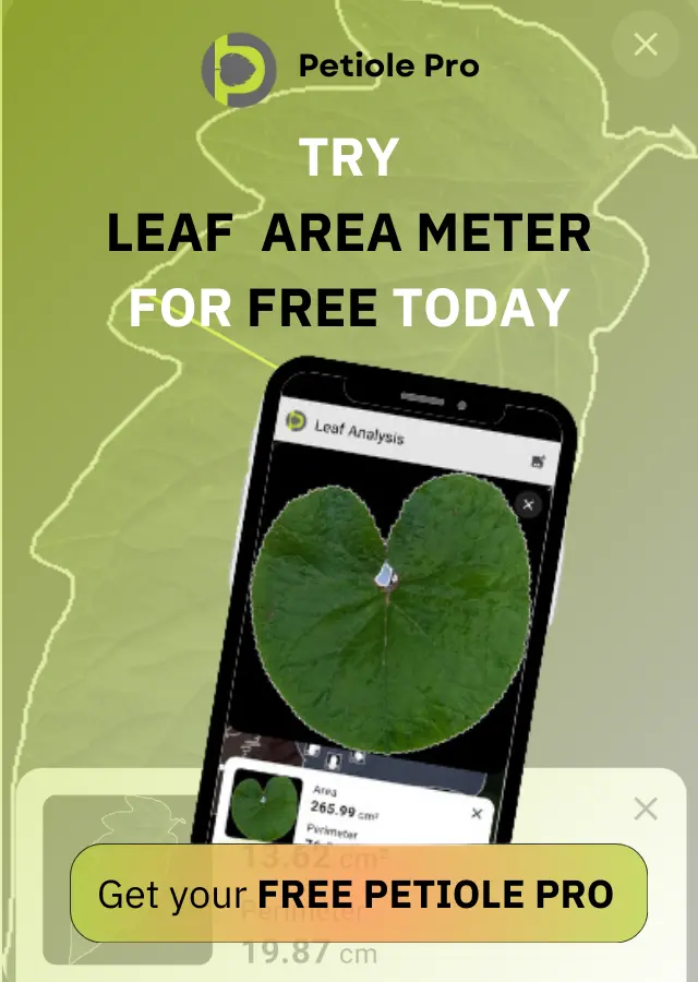
We have great confidence in Petiole, a mobile application that can be used to measure leaf area and assess chlorophyll content. It is an ideal tool for calibrating the results obtained from agricultural drones in the field.
The purpose of aerial photography in agriculture is to answer questions such as: How many weeds are in the field? What percentage of the plants are thriving? What type of soil is present? Without a specific purpose, it is impossible to accurately analyze aerial photos because it would take too much time to describe all the parameters, making the photos less valuable. Aerial photography allows us to see a snapshot of the field at a specific time, but the field is constantly changing. This is why the use of drones in agriculture, which can quickly and efficiently capture large areas, is so valuable.

3. Soil surveys are another important area where drones can be used in agriculture.
There are four main situations where aerial photography is particularly useful in agriculture, as no other method can provide such precise information about the soil. These include areas with a complex soil cover, as well as the organization of special-purpose areas such as airports, factories, and landfills.
Aerial photography is a useful tool for detailed characterization of the soil at testing stations. It can also be useful at experimental stations, forestry and nursery gardens. It is important to note that any soil reclamation and erosion research in stationary and semi-stationary conditions requires the creation of maps with data that can only be obtained using drones.
Soil mapping is an important aspect of growing demanding technical and horticultural crops such as tea, tobacco, essential oil, citrus fruits, and others.

4. Protection of the Crop
Agricultural drones can help protect crops by providing real-time information on threats such as theft, fire, and other unforeseen circumstances that may occur on the field and impact the crop.
One of the major benefits of using drones in agriculture is the speed at which they can capture images while maintaining good image quality. This enables farmers to quickly track any changes in their fields.
Stationary cameras do not have this capability. Furthermore, because of their speed, these automated “field guards” can cover a larger number of crops, especially if the fields are owned by the same person and are located nearby.

5. Adding Trichogramma and Chemical Treatment
Agriculture drones are a valuable tool in pest management, and Trichogramma is a natural and effective method for controlling pests that can damage crops. Trichogramma is a small butterfly that parasitizes the eggs of over 100 species of insect pests. By laying its eggs inside the eggs of these pests, Trichogramma effectively stops the development of the pests, providing organic pest control. There are several ways to apply Trichogramma to crops, but using drones to spray it is a particularly effective method.
The use of drones and quadrupeds in agriculture for plant protection has several benefits, including the ability to reduce the amount of expensive plant protection products needed by applying them more precisely and skipping treatment on headlands. In addition to chemical treatment, motorized hang-gliders and light aircraft are also commonly used for ultra-low volume spraying. However, there is still significant potential for agricultural innovators to enter the market for liquid pesticide spraying using drones and quadcopters. These technologies offer the opportunity to improve efficiency and reduce costs in plant protection.
Conclusions
Drones and UAVs (unmanned aerial vehicles) are crucial in these five areas of agriculture, but if you have any other ideas for using these technologies, we encourage you to share them with us. We are always interested in learning about new ways in which unmanned aircraft can be used in agriculture and would be happy to share your knowledge with the rest of the Internet.
It is also important to consider the potential drawbacks of using drones in agriculture. This information can be useful for those who are interested in this field, as it can help them avoid any potential problems in the future.